The listing below shows all club activities.
Contact details for each activity are available to paid-up members after logging into the member area.
1-17 Jul (Wed - Fri) 2026:
GRAMPIANS PEAKS TRAIL (H) Grampians Peaks Trail. Dates slightly flexible. Hard hike (grade 5) Similar or harder than the Larapinta. Expressions of interest to be followed by a meeting. Limit: 8. Map: .
2 Jul (Thu) 2026:
LANDCARE NORTH LEURA (E) Cancelled Join Blue Mountains council for a morning of landcare on the beautiful Brahma Kumaris property on Mt Hay Rd. Often we work on weeds in or along the pretty creek. This flows into Govetts Creek and hence into the National Park and eventually down to the Grose River. All instruction and equipment supplied. Morning tea supplied in the gorgeous Stone Cottage and you can stay for a yummy vegetarian complimentary lunch as well Limit: 8. Map: Katoomba.
4 Jul (Sat) 2026:
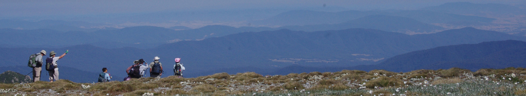
UPPER BLUEYS (M) Leura – Fairmont – Gladstone Pass – Lindeman Pass – Inspiration Point – Grand Cliff Top Walk (10 km)
A scenic circuit through cool rainforest and lush gullies, with a steady 250 m climb to Inspiration Point before returning via the Grand Cliff Top Walk. Expect soft light beneath the forest canopy, possibly damp feet, pleasing views, and a hundred shades of green. 10km Limit: 8. Map: Katoomba .
4 Jul (Sat) 2026:
WINDSOR TO CATTAI (H, kayak) Windsor to Cattai National Park and return 25km with the tide both ways. Please bring morning tea, lunch and P.F.D. Limit: 8. Map: Wilberforce.
Introduction Walk
5 Jul (Sun) 2026:
NEWNES PLATEAU, LOST CITY (E) Drive out to the Glowworm Tunnel Rd but turn left to the Lost City carpark. The name comes from all the pagodas in the valley and up the slopes which give it a lost city appearance. It's amazing. The track was only completed last year and is very well made [hence the easy] but, of course, has lots of steps as we'll walk down to the creek and the 2 old Lithgow dams, then up the other side to the northern lookout for views from a different angle and then return the same way. About 6 to 7 km return but the pace will be easy. Anyone who doesn't want to go the whole way can wait for us to return. There's also some history and remains of mining to be seen. Limit: 20. Map: Ben Bullen.
6 Jul (Mon) 2026:
PRESBYTERIAN CHERCH HALL, SPRINGWOOD (Exp) General Meeting:
Presentation: Junior members Abi Drew and Maddie Leonard to do a talk on Uluru and Kings Canyon following their participation in the Club activity there in May.
Catering: To be filled. Limit: 80. Map: Springwood.
9 Jul (Thu) 2026:
PEMULWUY BONNYRIGG CECIL HILLS (M) Bike Ride No.6 edited version POSTPONED until the 16/07/26
A 5 hr circuit suitable for road bikes following mostly cycleways with a few back road connections. Morning Tea will be at a new Cafe and lunch will be at the Parx Cafe in Abbotsbury ( near Calmsley Farm) which has all day breakfast and also a lunch menu,, or bring your own. Limit: 15. Map: Google maps.
11 Jul (Sat) 2026:
WENTWORTHS FALLS (M) 13km circuit on historic, established tracks.
Nature Track - Conservation Hut - Overcliff Track in a SE direction - Den Fenella Falls - Undercliff Tk - Grand Cliff Top Walk - Fetchers Lookdown - Charles Darwin walk, heading N in a gentle upstream direction alongside Jamison Ck - Park St - Central Park - Denis Kevans Bushland Park. Limit: 8. Map: Katoomba .
Introduction Walk
12 Jul (Sun) 2026:
GLENBROOK AND TRAIN LINES (E) This walk will include lookouts over Glenbrook Gorge, Darks Common and the building the 3rd railway ascent, the original railway ascent via the Zigzag, Lucasville Station and beautiful Knapsack Gully Viaduct, lots of early railway history including the station master's cottage and dunny, the 2nd ascent via the tunnel and more. This walk comes from Trevor McAlister's new book Exploring Hidden Sydney. Probably about 6 km with some up and down and one scrambly bit to get out of Tunnel Creek. Limit: 20. Map: Penrith and book.
Introduction Walk
12 Jul (Sun) 2026:
GLENBROOK TRAIN LINES (E) After a possible car swap which I have still to work out, we'll cover lots of railway history, including all three ascents. We'll visit Darks Common and the tramline built for making the trainline above the gorge plus lookouts over Glenbrook Gorge. Then we'll visit the original zigzag, Lucasville Station and the beautiful Knapsack Gully Viaduct which was originally a railway bridge, then a road bridge and now a pedestrian walkway. Then we'll try to get to the 2nd tunnel in Tunnel Creek with a bit of a scramble to get up and out of the gully.
Probably about 8 km. Limit: 16. Map: Penrith.
15 Jul (Wed) 2026:
SUN VALLEY (E) Sun Valley, Fire trail walk along Rosenthal Lane then into Long Angle Valley forest of bluegums, and return. Total 10 km. Very scenic, relaxed pace. Bring morning tea. Beautiful forests. Limit: 12. Map: Springwood.
15-17 Jul (Wed - Fri) 2026:
GLOW WORM TUNNEL TO NEWNES (M-H) Let’s go and enjoy the quiet of Newnes again while it is still largely inaccessible to the general public. It will be a new moon phase, so if the skies are clear we’ll have some great star gazing.
Day 1 - we’ll park at The Old Coach Rd trail and circle back up and through the glow worm tunnel then down into Newnes campground to setup base camp. 14km 330m descent 5hrs.
Day 2 - explore Petrie Gully and Echo LO. This bit is mostly on track but exploratory for me as I haven’t walked this bit before. Approx 8km with a day pack. 2 stretches of about 100m ascents 6hrs.
Day 3 - walk out the slightly shorter exit to The Coach Rd. About 12km 330m ascent 5hrs.
Although we are looking at 330m of ascent and descent, the walk in and out is a gentle slope as it follows the old rail line. Limit: 16. Map: Ben Bullen and Mount Morgan 1:25000.
16 Jul (Thu) 2026:
PEMULWUY BONNYRIGG CECIL HILLS (M) BIKE Circuit No 6
A 5 hr circuit suitable road bikes following mostly cycleways with a few back road connections. Morning tea will be at a new Cafe and lunch will be at the Parx Cafe in Abbotsbury ( near Calmsley Farm) which has all day breakfast and lunch menu or bring your own Limit: 15. Map: Google maps.
Introduction Walk
16 Jul (Thu) 2026:
PENRITH Early Evening Walk + Optional Social Activities
Brisk-paced 6.8 km walk with one sustained uphill climb. Sunset (5:07 pm) will be viewed from the M4 bridge overlooking the Nepean Gorge.
Meet: 4:00 pm at the Penrith end of Yandhai Bridge.
After the walk, anyone interested is welcome to join us for a meal at the Log Cabin Hotel, followed by an optional chamber music concert by the Omega Ensemble at The Joan, commencing at 7:00 pm. If you wish to attend the concert, please purchase your own ticket in advance.
https://www.omegaensemble.com.au/inner-landscapes#mobile-tickets
Map: Penrith
18 Jul (Sat) 2026:
GLENBROOK NP (E) We'll spend the day going to all the nice places in Glenbrook NP such as Mt Portal with views down to the river and Penrith and Tunnel View which looks down into Glenbrook Gorge, Euroka Clearing with a 2 km return walk to Nepean River, then Nepean Lookout with 1 km return walk ending in amazing views over Nepean Gorge, a 1.6 km return walk to Pisgah Rock with views over Erskine Creek and maybe end up driving to the short walk to Red Hands Cave if time and interest is there Limit: 16. Map: Penrith.
18 Jul (Sat) 2026:
WENTWORTHVILLE UNITING CHURCH The production manager of Humph Hall, a folk-music venue elsewhere in Sydney, is presenting an afternoon of free music with 17 musicians.
https://looselywoven.org/wind/ewExternalFiles/Close%20to%20the%20wind%20Poster%20Wentworthville.pdf Map: PROSPECT 1:25 000 9030-2N
18 Jul (Sat) 2026:
WESTERN SYDNEY SUBURBAN (M-VH) Running. 34km. Orphan School Creek loop. Incorporating many quiet pathways.
Anti-clockwise via spectacular Boothtown aqueduct, and Pho - of course! Early start.
Great map here - https://ebikerdiary.com/2018/08/10/orphan-school-creek-trail/ Limit: 8. Map: LIVERPOOL 1:25 000 9030-2S.
19 Jul (Sun) 2026:
PATERSON HILL - GROSE RIVER (H) Start at Vale of Avoca Lookout, Grose Vale. We will then descend via The Wire Track, which is a scramble with ledges but somewhat on track, down to Grose River. From here we will cross Burralow Creek and continue upstream towards Cabbage Tree creek, before heading up to the summit of Paterson Hill, 200m. Return the same way. Great views, mostly off track. 6km, 436m gain. Limit: 8. Map: Kurrajong.
19 Jul 2026 (Sun) 2026:
LANDCARE BIRDWOOD GULLY SPRINGWOOD (E) Spend the morning giving back to our beautiful bush. Just come whenever you can even if it's only once or twice a year. Bland Rd is right at the head of Birdwood Gully so weeds we remove from here will benefit the whole creek system down to the Grose River. We're mainly removing privet - big, medium and small to allow the lovely native ferns and trees to grow. It's led by council worker Tracy Abbas who provides tuition and equipment. We've been here for a year now and the difference is incredible. I've personally pulled up or cut and painted 1000s of privet. Council have allocated money to fix up the storm water drain, catch rubbish coming down from the highway and stabilize the creek line. Soon we can start planting as well. Limit: 8. Map: Springwood.
22 Jul (Wed) 2026:
NARROW NECKS (E-M) Walk Narrownecks Katoomba: also known as Glenraphael Drive, but closed for cars. Winter provides some of the best views off the Narrowneck Peninsula. There are deep valleys on both sides, either filled with clouds or filled with beauty. Walk about 5 km out and 5 km back, taking in the views. Easy pace, but there are hills. Limit: 16. Map: Katoomba, Jamison.
23 Jul (Thu) 2026:
THIRLMERE (E-M) 23 July, Bike Ride Thirlmere. Cycle from Thirlmere on Barbour Rd, turnoff into Thirlmere Lakes area on Slades Rd. Cycle to the Pumphouse and return along Slades Rd (Pumphouse Rd closed). Follow W Parade to Buxton, cross the rail line, left onto E Parade to Couridjah, Bargo River Rd, left to Colo St, right to Nattai St, left Byron Rd, Right Bronzwing Rd into Tahmoor, then back to Thirlmere. 23 Km total, some traffic on W Parade. Slades Rd probable dirt. Extra distance option if wanted. Bring snacks. Afternoon visit to rail museum. Limit: 12. Map: UBD.
25 Jul (Sat) 2026:
CENTRAL COAST HINTERLAND (H) Rogaining – NSW Championships 2026
Interested in joining me at the 2026 NSW Rogaining Championships, Lake Macquarie, 25–26 July?
Watagans area of Olney State Forest, west of Morriset.
Event options are:
6 hour
15 hour in 24
24 hour
Rogaining combines bushwalking, navigation, route planning and teamwork in a rewarding outdoor challenge. Experienced rogainers and newcomers are welcome.
Entry fee: $120 per person.
If you'd like to form a team or discuss the event, please contact me.
https://nswrogaining.org/event/2026-nsw-championships/ Limit: 5. Map: Modified. Supplied / Olney SF.
Introduction Walk
26 Jul (Sun) 2026:
GLENBROOK NP (E) A repeat of the walk on the 18th. We'll spend the day going to all the nice places in Glenbrook NP such as Mt Portal with views down to the river and Penrith and Tunnel View which looks down into Glenbrook Gorge, Euroka Clearing with a 2 km return walk to Nepean River, then Nepean Lookout with 1 km return walk ending in amazing views over Nepean Gorge, a 1.6 km return walk to Pisgah Rock with views over Erskine Creek and maybe end up driving to the short walk to Red Hands Cave if time and interest is there Limit: 16. Map: Penrith.
1 Aug (Sat) 2026:
NEWNES PLATEAU (M-Exp) Park just before the road tunnel on the glowworm tunnel road. Walk west up to ridge to and follow the ridge or spur N and NW to the cliff top. Work back and explore the slotty gullys and cliff line maybe making it as far as the top of the dry canyon catchment and return to cars. This is an exploratory wander that should have good views and a bit of scrambling. It won't be a long walk in distance. Limit: 6. Map: cullen bullen.
1 Aug (Sat) 2026:
SE SIDE LEURA (M) Leura – Fairmont – Gladstone Pass – Lindeman Pass – Inspiration Point – Grand Cliff Top Walk.
Re-listed walk from 4 July. Suitable for fit beginners.
All on historic tracks. 10 km. A scenic circuit through cool rainforest and lush gullies, with a steady 250 m climb to Inspiration Point before returning via the Grand Cliff Top Walk.
Expect soft light beneath the forest canopy, possibly damp feet, pleasing views, and a hundred shades of green.
Limit: 8. Map: Katoomba .
1 Aug (Sat) 2026:
VICTORY TRACK, JUNIOR MEMBER LEADER (E) Classic club walk. Junior members encouraged to join, all are welcome. Sassafras Gully to Perch Ponds and exit via yondell extension trail. Waterfalls along the way including Martin Falls and Magdala Falls. Roughly 9km. Co-Leader Jessie B. Limit: 8. Map: Springwood .
1-2 Aug (Sat - Sun) 2026:
HAWKESBURY RIVER WISEMANS FERRY (H, kayak) Kayaking from Lower Portland to Wisemans Ferry and return 40 km, staying over night at Wisemans Ferry and returning with the tide. Limit: 8. Map: Lower Portland & St Albans.
2 Aug (Sun) 2026:
KANUKA BROOK AND RED HANDS CAVE (M-H) We'll walk into Glenbrook Creek and cross near the Duckhole, go a little way up pretty Kanuka Brook, and then ascend a short ridge to the disused end of Red Hands Cave firetrail. From there we will walk to Red Hands Cave, and walk on the newly-maintained track down Camp Fire Ck. We'll cross Glenbrook Ck again at the Blue Pool or causeway. A mixture of informal track, firetrail and formed tracks and nice loop to take in some of the highlights of this part of the national park. About 11km. Elevation gain of approx 250m Limit: 8. Map: Penrith .
2 Aug (Sun) 2026:
WOODFORD (E) History: From First Nations, to Woodford Academy, to what it was to be a couple of gay men in the '50's &'60's. Walk from Woodford down to the ruins of Jon and David's house, to Jon's rock, down the Fairfax track to Edith Falls, then the Transit of Venus , Mabel Falls and back to the Academy. About 4 hours, about 120 mtrs elevation, road, fire trail, track. Train from Sydney arrives 8:46 am. Bring lunch. Limit: 8. Map: Katoomba.
3 Aug (Mon) 2026:
PRESBYTERIAN HALL SPRINGWOOD (Meeting) Meeting:
Supper:Janette L.
Presentation by NPWS Representative.
RECREATIONAL GROUPS - FERAL DEER MANAGEMENT
Using Citizen science to help protect the Blue Mountains World Heritage Area from
deer incursions. Limit: 60. Map: Springwood.
6 Aug (Thu) 2026:
LANDCARE NORTH LEURA (E) Join Blue Mountains council for a morning of landcare on the beautiful Brahma Kumaris property on Mt Hay Rd. Often we work on weeds in or along the pretty creek. This flows into Govetts Creek and hence into the National Park and eventually down to the Grose River. All instruction and equipment supplied. Morning tea supplied in the gorgeous Stone Cottage and you can stay for a yummy vegetarian complimentary lunch as well if you wish Limit: 8. Map: Katoomba.
7-10 Aug (Fri-Mon) 2026:
CAPERTEE VALLEY 7-10 August painting trip Capertee Valley. Instead of walking the landscape, I will be painting it. Staying on private property with 4 caravans, 2 campsites, toilets, showers, open kitchen. Vans $200 for the whole 3 nights. No tuition, byo everything. First in first served. Great area for landscape painting. Map: UBD
8 Aug (Sat) 2026:
JAMISON VALLEY (H) Cedar Gap, Katoomba to Sublime Point, Leura.
Golden Stairs - Ruined Castle - off-track navigating ENE down to the Kedumba River. Up to W7F Sublime Point Trail, up to Copeland Pass, including fun climbing through that circular hole in the rock. Sublime Point Lookout.
Car shuffle required. Minimum 17km distance, with 900m accumulative climbing.
Limit: 8. Map: Katoomba .
Introduction Walk
8 Aug (Sat) 2026:
WARRIMOO TO BLAXLAND VIA FLORABELLA PASS (EM) Leave some cars at Blaxland and drive to the beginning of pretty Florabella Pass in south Warrimoo. It's 6 km walk with an extra km or less return to detour down to Glenbrook Creek but this is optional. There are steps at the beginning and the end of course and the track undulates a fair bit but we have plenty of time. Plenty of rock overhangs and nice creek sections. Limit: 16. Map: Springwood.
Introduction Walk
9 Aug (Sun) 2026:
HORSESHOE FALLS CIRCUIT NORTH HAZELBROOK (E) A lovely short 4 km circuit walk going past 4 waterfalls - two with amazing overhangs where glowworms can be seen at night. The creek is very pretty too. Limit: 20. Map: Katoomba.
15 Aug (Sat) 2026:
LEADERS BBQ Leaders and those who would like to consider becoming a leader, save this date for a get-together and BBQ. Location 3 Davies Ave, Springwood Starting 12 noon. We will discuss what a leader’s responsibilities are, share ideas and tips, and generally encourage each other. Bring a camp chair, cutlery, cup and plate, but all food and drink will be provided.
16 Aug (Sun) 2026:
LANDCARE BIRDWOOD GULLY SPRINGWOOD (E) Spend the morning giving back to our beautiful bush. Just come whenever you can even if it's only once or twice a year. Bland Rd is right at the head of Birdwood Gully so weeds we remove from here will benefit the whole creek system down to the Grose River. We're mainly removing privet - big, medium and small to allow the lovely native ferns and trees to grow. It's led by council worker Tracy Abbas who provides tuition and equipment. We've been here for a year now and the difference is incredible. I've personally pulled up or cut and painted 1000s of privet. Council have allocated money to fix up the storm water drain, catch rubbish coming down from the highway and stabilize the creek line. Soon we can start planting as well. Limit: 8. Map: Springwood.
22-23 Aug (Sat - Sun) 2026:
LIONS HEAD PASS TO KEDUMBA CROSSING (M-H) August is Platypus Awareness Month so I’m keen to head back to Kedumba Crossing where I previously enjoyed watching them frolick for a good 30 mins from my campsite. (No refunds if we don’t see a platypus????)
The first part of the walk along Lion’s Head Ridge is about 3.5km and rated easy-medium. If anyone wanted to just do this section as a day walk and return solo I would be happy for that. Please let me know when you book on.
The traverse down Lion’s Head Pass is quite steep with some off-track. (About 2kms with a 600m descent). Hopefully we will be rewarded with a platypus sighting at Kedumba Crossing at dawn/dusk.
There should be some time either Saturday afternoon or Sunday morning to explore some of the graves and ruins in the area.
We’ll return the same way (yep, 600m up!) because I hate the fire trail up Kedumba Valley Rd. (Short and sharp rather than long and boring!)
12km across the weekend plus a bit extra for any exploring.
Limit: 15. Map: Jamison 1:25000.
24-28 Aug (Mon - Fri) 2026:
TOMINGLEY (M-H) 4 day cycle tour Tomingley-Geurie-Yeoval-Peak Hill-Tomingley. 45-60 km each day, staying in pubs if possible, otherwise camping. Contact Barney S for more details if interested. Limit: 6. Map: UBD.
28-30 Aug (Fri - Sun) 2026:
NAVSHIELD (M-H) This years NavShield is being held in Belanglo State Forest.
The plan will be to go in on the Friday afternoon, compete on Saturday only, and return home Sunday morning (or Saturday night if people prefer).
Navshield (Australian Emergency Services Wilderness Navigation Shield) is an annual wilderness navigation event delivered by NSW SES Bush Search and Rescue (BSAR). Using only map and compass, teams navigate rugged bush terrain to locate checkpoints, building teamwork, endurance and practical land search capability in a realistic field environment.
I’ll need to put teams together ASAP as registrations close on 2/8.
Teams of 2-4 will be created as people book on. If you have a preference for who you would like to be in a team with, please advise when you book.
Once I have some teams it will be up to individuals to go online and register themselves on the NavShield site.
https://www.ses.nsw.gov.au/navshield
Entry for the one day event is $100.
Limit: 16. Map: Moss Vale, Mittagong, Hanworth, Canyonleigh.
3 Sep (Thu) 2026:
LANDCARE NORTH LEURA (E) Join Blue Mountains council for a morning of landcare on the beautiful Brahma Kumaris property on Mt Hay Rd. Often we work on weeds in or along the pretty creek. This flows into Govetts Creek and hence into the National Park and eventually down to the Grose River. All instruction and equipment supplied. Morning tea supplied in the gorgeous Stone Cottage and you can stay for a yummy vegetarian complimentary lunch as well Limit: 8. Map: Katoomba.
7 Sep (Mon) 2026:
PRESBYTERIAN HALL SPRINGWOOD (Meeting) Meeting:
Presentation: Sam Porritt to speak about Rogaining
Supper: Maree J. Limit: 8. Map: Springwood.
12 Sep (Sat) 2026:
WILDFLOWERS OF YILEEN SPUR (M-Exp) This is an exploratory trip for me.
We’ll head out along a spur between Yileen Gully and Yileen Spur towards the cliff edge overlooking Pierce’s Pass where we’ll stop for lunch. We then return along Yileen Spur and back to the cars.
Hopefully at this time of year we will see plenty of wildflowers.
281m elevation change, 7.2km. Limit: 12. Map: Mount Wilson 1:25000.
18-20 Sep (Fri - Sun) 2026:
ROGAINE LANE COVE RIVER FERRYGAINE (E-M) This is early notice for what is shaping up to be a truly first-of-its-kind rogaine, so please put it into your calendar now.
As this is expected to be a hugely popular weekend for rogaining and orienteering (yes, we have a warm-up orienteering event on Saturday as well). It is encouraged that we book our camping/glamping on the Island INDEPENDENTLY as soon as possible to avoid missing out.
Limit: 8. Map: Sydney .
20 Sep (Sun) 2026:
LANDCARE BIRDWOOD GULLY SPRINGWOOD (E) Spend the morning giving back to our beautiful bush. Just come whenever you can even if it's only once or twice a year. Bland Rd is right at the head of Birdwood Gully so weeds we remove from here will benefit the whole creek system down to the Grose River. We're mainly removing privet - big, medium and small to allow the lovely native ferns and trees to grow. It's led by council worker Tracy Abbas who provides tuition and equipment. We've been here for a year now and the difference is incredible. I've personally pulled up or cut and painted 1000s of privet. Council have allocated money to fix up the storm water drain, catch rubbish coming down from the highway and stabilize the creek line. Soon we can start planting as well. Limit: 8. Map: Springwood.
26-27 Sep (Sat - Sun) 2026:
KU-RING-GAI CHASE NP / PITTWATER (E) Beginners Overnight Adventure – Ku-ring-gai Chase National Park
26–27 September 2026
Suitable for beginners with reasonable fitness. No previous overnight experience required.
Join us for a relaxed introduction to overnight bushwalking in one of Sydney’s most beautiful national parks. Aboriginal heritage, beaches, and the chance to see Sydney’s spectacular sandstone wildflowers in bloom.
We begin with an easy 7 km return walk along the scenic Bairne Trail (without packs), before returning to prepare for our first overnight experience carrying light camping gear. We then walk a gentle 4 km track down to our waterfront campsite at The Basin, where we can enjoy an evening beside the water.
On Sunday morning, we take the pleasant ferry around to beautiful Great Mackerel Beach. From there, we explore the coastline on a pack-free walk to West Head, visiting Aboriginal rock engravings and the secluded Resolute Beach area. We finish with a scenic return walk past the historic beach shacks up to our cars.
A great first overnight walk for those wanting to experience camping, coastal scenery and the camaraderie of a bushwalking group. Limit: 20. Map: BROKEN BAY 1:25 000 9130-1N.
27 Sep (Sun) 2026:
WOODFORD LAKE AND MORE (EM) A repeat of a walk I did in June. A 6km round walk taking in a nice rainforest gully, pretty Gemimi Falls, Woodford Lake and Dam and an amazing rock shelf with aboriginal handprints. The colours and shapes of the rock shelf are breathtakingly fantastic. Well worth the firetrail walking involved and some easy bushbashing to get to the site. Limit: 20. Map: Katoomba.
27 Sep-2 Oct 2026 (Sun - Fri) 2026:
HIDDEN CREEK JERVIS BAY (M, kayak,walk,cycle) Five nights at Hidden Creek Caravan Park overlooking Currambene Creek. Tent or caravan on a campsites we have to ourselves.$25 per person per night. Cabins are also available at a discounted rate. We will be doing a number of day paddles in the surrounding waterways with opportunities for cycling, walking and swimming. Limit: 16. Map: Jervis bay.
Introduction Walk
4 Oct (Sun) 2026:
GLENBROOK NP RED HANDS CAVE (E) Park near the causeway and walk up Campfire Creek to Red Hands Cave to see some aboriginal stencil art. Return the same way with a small loop possible. This track has been recently fixed up and gently climbs to the cave. It's about 8 km return. Afterwards we can drive to Mt Portal Lookout if people haven't been there. Limit: 16. Map: Penrith.
17 Oct (Sat) 2026:
WILDFLOWERS OF JINKE (M-Exp) This walk is an exploratory for me.
We’ll head out along Jinke Track, the bear towards Jungaburra Brook, staying on top of the plateau to Wilkinson Hill, looking across to Valhalla Head, where we’ll stop for morning tea. We then retrace our steps and head along Jinke Ridge to the cliff line overlooking Dalpura Creek for lunch before returning to the cars.
Should be plenty of wildflowers out and the views should be spectacular.
9km with 217m elevation change. Limit: 12. Map: Mount Wilson 1:25000.
18 Oct (Sun) 2026:
LANDCARE BIRDWOOD GULLY SPRINGWOOD (E) Spend the morning giving back to our beautiful bush. Just come whenever you can even if it's only once or twice a year. Bland Rd is right at the head of Birdwood Gully so weeds we remove from here will benefit the whole creek system down to the Grose River. We're mainly removing privet - big, medium and small to allow the lovely native ferns and trees to grow. It's led by council worker Tracy Abbas who provides tuition and equipment. We've been here for a year now and the difference is incredible. I've personally pulled up or cut and painted 1000s of privet. Council have allocated money to fix up the storm water drain, catch rubbish coming down from the highway and stabilize the creek line. Soon we can start planting as well. Limit: 8. Map: Springwood.
18-29 Oct (Sun-Thu) 2026:
NORTHERN JAPAN (E-M-H) THIS TRIP IS FULL I am putting out this EOI as I've had a few requests for a repeat of the walking trip to Japan that I did in 2024. We would do a variety of day walks in the northern part of Japan (parts of Hokkaido and Aomori). I will lead walks that I am have done previously. It will be autumn-leaf time and scenery should be fabulous. We will stay in hotels/inns/AirBnB/hostels and hire vehicles to travel around. At the moment there are very few other details I can give because we need to have a meeting asap of those interested. The meeting will need to be late March or early April, so please "book" on the program soon to show your interest. This will not be a binding commitment to participate. Limit: 8. Map: .
25-30 Oct (Sun - Fri) 2026:
CANBERRA ANNUAL CYCLING EVENT (E-M-H-Exp, possible gravel) It's on again because last year was yet again a big success and because there are myriad more paths to explore! Staying at a Van Park where you can choose to camp, caravan or cabin. We will be doing a series of day rides on the magnificent and highly varied network of bike paths around Canberra- where navigation can sometimes be a challenge, hence exploratory. Opportunities for enjoying cafes, tourist features, lakes, vistas, paddocks, forests, parks, looking over fences and admiring well planned infrastructure. Cycling distances vary between 30 and 70km. Flexible and cruisey. No pressure to ride everyday. Some days there may be riding choices. Limit: 20 riders. Limit: 8. Map: Canberra cycling map.
5 Nov (Thu) 2026:
LANDCARE NORTH LEURA (E) Join Blue Mountains council for a morning of landcare on the beautiful Brahma Kumaris property on Mt Hay Rd. Often we work on weeds in or along the pretty creek. This flows into Govetts Creek and hence into the National Park and eventually down to the Grose River. All instruction and equipment supplied. Morning tea supplied in the gorgeous Stone Cottage and you can stay for a yummy vegetarian complimentary lunch as well Limit: 8. Map: Katoomba.
14 Nov (Sat) 2026:
DUMBANO TUNNELS (E-M) I’m chasing Waratahs and there should be heaps in the area. If not, the area has enough interest anyhow. - rock pagodas, camp cave, the “tunnels“ and fabulous scenery. Only about 7km walk in total but it is almost all off-track and you will get wet at least to your knees. Involves a bit of rock scrambling as well and some up and down 50 – 70m hills. We will need AWD/4WD to access the start from Newnes Plateau. I have space for 4 in my AWD which will make it unless it rains a lot, but someone with a 4WD would be great. Limit: 8. Map: Wollangambe.
21-22 Nov (Sat - Sun) 2026:
WESTERN CREEK EXPLORE (M-Exp) We’ll walk west in from Martin’s Lookout to our campsite at the junction of Western and Sassafras Creeks. 1.5km
Donning daypacks, we’ll head up through Shark’s Head Cave to Lost World Lookout. There is a slot to navigate and a bit of climbing which might need a hand line to navigate. After following the Lost World trail briefly, we head west to try and find a route down to Western Creek. I did a brief explore of the creek and it is a wide cool creek with lots of good rock hopping. We’ll aim to follow the creek back to our campsite. 4km explore.
If we can’t get to the creek this way, we may need to return the way we came and then do an up and back instead, but it would be good to find a circuit route if possible.
A slow start on Sunday with a swim at a waterhole in Sassafras Creek before heading up the Eastern approach to Martin’s LO. 4km. Should be out early afternoon.
100m ascent/descent to campsite and 170m ascent for explore.
Limit: 10. Map: Springwood 1:25000.
28 Nov (Sat) 2026:
NORTH SPRINGWOOD MAGIC FIREFLY AND GLOWWORM WALK (E) Meeting at 8 pm at the end of Bednal Rd with torches, we walk less than a km down into Birdwood Gully to wonder at the fireflies doing their mating dance. It's like fairy land. When they've finished the glowworms have lit up so we walk down the creek a little to Madeleine Glen. Less than 2 km return but sheer magic. Limit: 20. Map: Springwood.