1-14 Aug (Sun-Sat): LARAPINTA 2ND ATTEMPT (E-M-H, arid, hot) Suspended due to covid. expression of interest - Sometime in August, depending on bookings and covid restrictions. We were thwarted last year by a lockdown. Booking fee after July will be $29 a night (an increase from ? nothing??) and we may have to use a booking system that doesn't yet exist, but this is an ideal time of year to attempt this iconic trail. Limit: 8. Map: Larpainta Trail map (
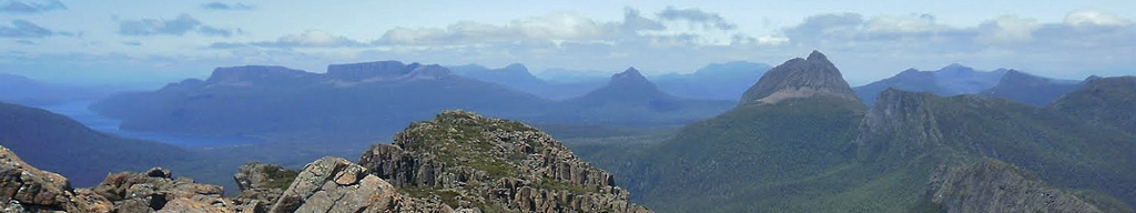
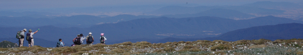
2021)1-20 Aug (Sat-Thu): LARAPINTA TRACK NO.3 (M-H-X, desert) Larapinta Trail, MacDonnell Ranges NT. If you missed the 2014 trip, and you can't join Greg in July, this is another chance to do this iconic walk. We're not trying to compete with the other trips, we just couldn't go on those dates. Contact one of us as soon as possible, we plan on booking transport soon. Return flights to Alice are still around $650. 223 km, food drop to be organised, but we're doing it the hard way - no support vehicle. Map package from: www.parksandwildlife.nt.gov.au/parks/walks/larapinta/package#.VMtr6WiUfAw Limit: 6. Map: order online (
2015)2-3 Aug (Sat-Sun): BLACKHORSE RIDGE CAMPSITE EXPLORATION (E-M) Cancelled, due to rain - lots of it. From Dunphy's carpark, walk out to Lake Birrel (around 7-8 km, on the firetrail), set up camp then continue on with day packs to the Mobbs soak track. Somewhere along that track is a campsite which has disappeared since the 2019-20 fires. We think we know the location and we plan to find it. (Any excuse for a weekend out in the Wild Dogs). If we find the campsite, we'll continue on to look for the Blackhorse Ridge trail. Limit: 8. Map: Jamison, Jenolan (
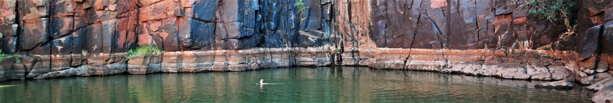
2025)2-11 Aug (Thu - Sat): KAKADU () An off-track walk from Jim Jim Falls to Koolpin Gorge, crossing the plateau offering diverse landforms and vegetation, cultural sites and oodles of waterholes (without crocs). This is not a guided walk. We have a party of 3 with a vacancy for just one more, due to transport logistic limitations. You'd need to arrive in Darwin by the afternoon of 31 July, and leave no earlier than the afternoon of of 12 August. Limit: 4. Map: Jim Jim, Koopin 1:25000 (
2018)2-18 Aug (Fri - Sun): LARAPINTA (M-H) Classic long walk in the amazing West MacDonnell ranges west of Alice Springs. We will start at Mt Sonder and walk back to Standley Chasm. Water is available at most campsites, and food drops are arranged with transport through a company in Alice. We fly into Alice on Friday 2nd August, start the trek on Sunday 17th August.
NT now charges for camping, around $250 (track fee and 12 campsites). Transport and food drops are extra (around $160). Qantas flights are around $400 each way.
NOTE: Arrangements have now been made and paid for. We do have a waiting list in case of cancellations. Limit: 8. Map: Free maps available online (
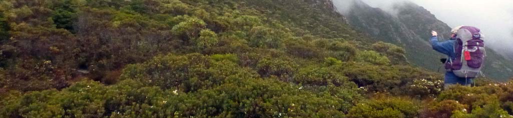
2024)2-6 Aug (Tue - Sat): WESTERN BUDAWANGS () Arguably my favourite bush exploration area. Expect a closely packed variety of wondrous overhangs, arches, waterfalls, expansive views and rainforest pockets. Day one: Early start. Drive to Wog Wog then 9km to a small but pleasant camping cave in the Goodsell Basin. Days 2, 3 and 4 are for day pack exploration in the upper Goodsell basin. Day 5: Return via the Scenic Rim Walking Track circa 10km.
Limit is size of camping cave. Preference is given to experienced off-track overnighters who have previously expressed interest in exploring this area. . Limit: 5. Map: Corang (
2022)3-4 Aug (Sat - Sun): HAWKESBURY RIVER WISEMANS FERRY () Kayaking from Lower Portland to Wisemans Ferry and return 40 km, staying over night at Wisemans Ferry and returning with the tide. Limit: 8. Map: Lower Portland & St Albans (
2019)4 Aug to 11 Sep (Sat-Tue): CHINA (M, travel) 13 day tour Tiger Leaping Gorge, Kunming, Dali, Shaxi, Lijiang, Shangri-La. Includes a 2 day walk through the Gorge. Snow capped peaks, winding trails, World Heritage listed villages. Limit: 8. Map: China (
2012)4-5 Aug (Sat-Sun): HAWKESBURY RIVER WISEMANS FERRY (H, kayak) Kayaking from Lower Portland to Wisemans Ferry and return 40 km, staying over night at Wisemans Ferry and returning with the tide. Limit: 8. Map: Lower Portland & St Albans (
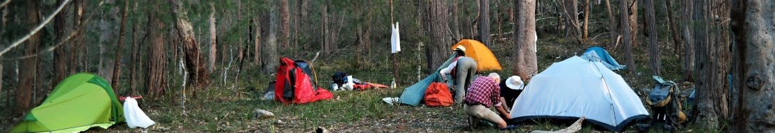
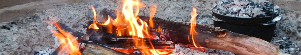
2018)6-8 Aug (Sat-Mon): PUTTY CAMP AND PRIVET CONTROL (E) A Friends of the Colo activity. Car-based camping in delightful surroundings on a private rural property. Come for the 3 days, or just the weekend. Help continue the privet control through farmlands along nearby Putty Creek, to protect the wild Wollemi Creek further down. Families welcome (providing someone does some priveting), with an option for easy short walks on farmland or adjacent State Forest. Enjoy a good social around the campfire in the evenings. The activity will be led by long-time FOC member Ian Partridge. Limit: 15. Map: Putty (
2016)6-7 Aug (Sat-Sun): PUTTY CAR-BASED CAMP (E) Join this Friends of the Colo activity for a convivial car camp and campfire on private property in the Putty Valley. Do some easy weed control work or simply relax. Limit: 20. Map: Putty (
2011)7-21 Aug (Sat-Sat): BORDER RANGES-THE SCENIC RIM, GWONDANA FORESTS () This 2 week odyssey will take us on a circuit thru the ancient forests of Gondwana. Starting at Tenterfield, we'll look at Border Ranges, Barney, Lindsay and Maroon, then on to Lamington and Springbrook, finishing at Mt. Warning. Camping only, no caravans.
Day walks only. Limit: 12. Map: Various (
2010)7-8 Aug (Sat-Sun): GROSE RIVER - BLUE GUM FOREST () Another Blue Mtns classic - start at the Victoria Falls track, walk down the Grose River to Blue Gum Forest, camp at Acacia Flat. Return via Govett's Leap, which is a long climb, but not difficult if you take it slowly. Car swap needed. Limit: 8. Map: Katoomba, Mount Wilson (
2010)7-9 Aug (Fri-Sun): PUTTY CAMP AND PRIVET BASH (E) Organised by Friends of the Colo. Car-based camping on a private rural property. Come for the 3 days, or the weekend, or even just for a day. Help with privet control through farmlands along Putty Creek, to protect Wollemi Creek further downstream. Families welcome (providing someone does some priveting), with an option for easy short walks on farmland or adjacent State Forest. Enjoy a good social around the campfire in the evenings?especially on Saturday night when we?ll informally celebrate 15 years of Friends of the Colo! Limit: 20. Map: Putty (
2015)8-12 Aug (Sun-Thu): BUDAWANGS C QUILTY MOUNTAIN EXPLORE ((M-H-X, Scrub, Cliff) Suspended due to covid. Another epic exploratory in my all time favourite bushwalking area. Day 0:travel to airbnb and stay overnight. Day 1: Black Bobs Creek, cross Corang River, Square Top track, 11km. Day 2: skirt south side of Square Top. Over Fosters Mountain, cross Sally Creek. Ascend Quiltys Mountain and explore the amazing headwaters of Nomchong Creek 7km. Day 3: Endrick Peak, Bora Ground, Sally Creek 11km. Day 4: Return to cars via Square Top track 12km. km are bush kilometers. Camping may be on rock platforms. Dates are negotiable. Limit: 5. Map: Endrick, Corang (
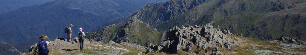
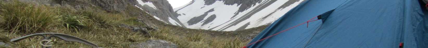
2021)8-11 Aug (Fri-Mon): KOSCIUSZKO NP (M-H, Grade 4) Cross-country ski and snowshoe trip. Guthega Power Station - Mawson's Hut - Mt Jagungal - Tin Hut - GPS. Not for beginner skiiers; snowshoes are so easy to master - but it is hoped that you will have had experience with those on day trips if you wish to come. Bit of shlepping to N2 camp on snow at Jagungal Saddle, which exceeds 2000m ASL. Wonderful vistas await. Limit: 6. Map: Various available (
2014)8-31 Aug (Sat-Mon): NORTHERN NSW (M) Due to border closure, we're now doing the national parks of northern NSW.
Camping and cabins, with 3 night stays and walking from the base camps. FULL Limit: 12. Map: NORTHERN NSW (
2020)8-11 Aug (Fri-Mon): PUTTY () A Friends of the Colo activity. Car-based camping in delightful surroundings on private rural property. Come for the 4 days (Friday-Monday), or the weekend, or just for a day. Help continue with the privet bash along nearby Putty Creek, the importance of which recently skyrocketed after our discovery of privet on the Colo in the downstream wilderness. Families welcome (providing at least one family member is priveting), with an option for short easy walks on farmland or State Forest. Enjoy a good social around the campfire in the evenings. A BBQ will probably be laid on for us on the Saturday night. Limit: 20. Map: Putty (
2014)9-12 Aug (Sun-Wed): MOUNT WIRRABA (H) From a Putty property, walk to and explore the Mount Wirraba vicinity, checking out the rocks which Surveyor Peter Ogilvie sampled in 1832. Commence on the Sunday afternoon after Putty privetting with Friends of the Colo, or drive up on Sunday and meet us there. Camps on Wollemi Creek and Mount Wirraba. Limit: 6. Map: Wirraba (
2015)10-11 Aug (Sat-Sun): PUTTY VALLEY (E) This is a Friends of the Colo activity. Car-based camping in delightful surroundings on private rural property. Help continue with the privet bash along Putty Creek—and enjoy a good social around the campfire. Families welcome. Bring home some firewood or cow poo if you like. Limit: 20. Map: Putty (
2013)11-13 Aug (Tue - Thu): IRON POT AND JENOLAN RIVER PACK WALK () From as close as we can get to Carlons-- then Green Gully, Iron Pot Mountain, Tin Pot Mountain, Goolara Peak, Jenolan River. Explore Cox River and Flaggi Clear. Return via Breakfast Creek and Carlon Creek. One of the few areas open for longer walks. Limited spaces due to campsite and covid restrictions. 500m descents and ascents in rough country.
Limit: 3. Map: Jenolan (
2020)11-12 Aug (Sat-Sun): MT SOLITARY (E-M, steep climb) If you've never camped on Solitary you should do this walk. Even if you have, you should do it again. A classic Blue Mountains walk, starting from Golden stairway, climbing up the knife edge (Korowal), camping at Chinaman's Gully and returning the same way. Fantastic views to Warragamba Dam. Korowal is 250m (up and down), the Golden Stairs are 150m (up and down) but total distance is only about 7 km each way. Limit: 8. Map: Katoomba, Jamison (
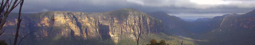
2012)11-13 Aug (Wed-Fri): NATTAI (M-X) A walk on the Nattai Tableland where we will get great views over the Nattai River valley. Mostly off track. We will have to go after rain, water is an issue.
Limit: 8. Map: Hilltop, Nattai (
2010)14 Aug to 16 Sep (Thu-Tue): EUROPEAN ALPS () Advance Notice. We're in the planning stages of a trip to Italy, Switzerland and France.
In Italy, the Cinque Terre coastal walk, then on to Lake Como and the Dolomites, which are possibly the most picturesque mountains in Italy, with food, views, history and culture. Also time to sightsee in Florence. Approx. 2 weeks.
In Switzerland, we'll base in the Bernese Oberland in the heart of the Alps to use cable cars and rack and pinion rail to access some of the alp's best walks. Leaving Interlaken, we'll head for Brig, with mountain views, walking etc. then on to the Matterhorn, before crossing in to France; Chamonix and Mont Blanc with time to ride the cable car to Aiguille du Midi and to Courmayeur in Italy. Home via Geneva.
All day walks from a comfortable base, close to the action. Expressions of interest.
THIS WALK IS NOW FULL, WITH A WAITING LIST Limit: 12. Map: Euro Map, Hallwag International (
2014)14-21 Aug (Sun-Sun): SNOWY MOUNTAINS SKI CROSS COUNTRY (M-X) Ski from Munyang to Tin Hut via Disappointment Spur, then along the Brassy Mountains and Bulls Peaks to Cesjacks Hut and on to O'Keefes Hut, Mount Jagungal, Mawsons Hut, Kerries Ridge, Gungartan Peak, Dicky Cooper Bogong and back down to Munyang (Guthega) power station. Experience the wonder of skiing under a full moon. Pace will be slow enough to accommodate fit snowshoers. Route may vary according to weather conditions and snow cover. Note this activity type is covered by SBC insurance. Limit: 8. Map: Spatial Vision Kosciuszko Alpine Area 1:50.000 (
2016)14-24 Aug (Fri-Mon): WAS LARAPINTA, NOW NSW (M-H, hot, dry) Not happening due to COVID. Alternate places being explored but being thwarted by flooding rains.. The plan is now to start at the Warrumbungles, possibly Wedding Cake Rock (off track) and Breadknife (the standard loop) in the park, then Sculptures in the Bush and Dandry Creek, Pilliga Pottery and sandstone caves, then (depending on roads open) Bourke, Mutawintji NP, Broken Hill. There is an option to return home on the train from BH, then Menindee or Kinchega. Limit: 8. Map: Hema maps NW NSW (
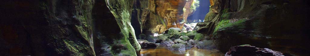
2020)15-16 Aug (Sat-Sun): A WEEKEND OF EXPLORATION AND DISCOVERY () One of the objectives we've been to, the other we've not, so it may be self-discovery. Sat:very early start. Object 1-Mid Winter Canyon; no abseils, but some very cold water to wade in a very narrow and sustained canyon. Object 2-The Lady Bushranger's Cave on Nullo Mt. We've not been there; have read the book, but Paul and Sue have given us some info and a dubious map, so who knows? Camp at Mid Winter Sat. night at the cars. Bring warm clothes and volleys. Limit: 10. Map: Olinda,Coorongooba and Growee (
2009)16-17 Aug (Sat-Sun): BEDFORD CREEK COMPLETION ((M-H-X, Scrub, Cliff) Completion of the walk which was washed out in April. Walk down Bedford Creek from Murphy's Glenn to camp on the creek below the Wheel. The next morning we ascend a side creek and make our way towards Scorpion Hill but turn east for a gentle descent to an interesting saddle. Lastly we walk downstream along Bedford Creek to Murphys Glenn. 16km approx including 4km fire trail. Limit: 8. Map: Jamison (
2014)16-17 Aug (Sat - Sun): NAVSHIELD () Every year NSW SES Bush Search and Rescue organises and runs the Australian Emergency Services Wilderness Navigation Shield or Navshield.
This is a fantastic opportunity to practice your navigation skills (even if you're just learning, you'll be in a team). Register your interest here, we will need to book our places as they fill up fast. NOTE: this is for the 1-day event, you will need to be able to travel to the venue on Friday, leaving at mid-day. If anyone is crazy enough to do the 2-day, let me know when you book. Limit: 12. Map: not released yet (
2025)16-18 Aug (Fri - Sun): PUTTY CAMP AND PRIVET CONTROL () A Friends of the Colo activity. The annual privet control weekend at Putty. We’ve stopped calling it a “privet bash” because there’s actually not much privet to be found any more: most of the time is spent wandering along pleasant river banks through farmland or state forest. Car-based camping in lovely surroundings on private property. Come for the 3 days (Friday-Sunday), or just the weekend. Limit: 20. Map: Putty (
2019)17 Aug to 6 Sep (Sun-Sat): MONGOLIA () MONGOLIA TRIP Onda Travel 21 days ex-Beijing, $4,400. Spend some time in the capital, Ulaan Baatar, followed by a 15-day trip to the wonderful countryside. This is essentially an outdoors trip, but there will also be time in rural towns for markets, museums, etc. In addition there may be a chance to visit a nomad family in their ger. Stay mostly in ger camps (nomadic tents suitable for tourists) and these are generally not near towns. This trip was proposed by Yvonne in 2009, run by Onda Travel, and Jeanette has done the trip recently, giving it the thumbs up. Need to nominate reasonably quickly. Limit: 5. Map: Outer Mongolia. Peter G T 4751 9474 peter@pwgreen.id.au Limit: 5. Map: Outer Mongolia (
2014)18-19 Aug (Sat-Sun): KANANGRA: GINGRA CREEK (M-H) Kanangra Walls, Crafts Walls, Crafts Ridge and then camp along Gingra Creek. On Sunday we will ascend onto the Gingra Range approximately at fourth top and then by track to Coal Seam Cave and return. A classic round trip of approx 25km. Limit: 8. Map: Kanangra (
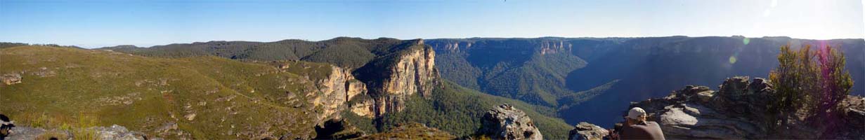
2012)19-20 Aug (Sat - Sun): VICTORIA FALLS TO PERRY’S LOOKDOWN (M-H) We’ll leave some cars at the end of Hat Hill Rd and shuffle around to Victoria Falls Lookout. Day 1 goes down to the base of Victoria Falls, through Burra Korain Flat and along the Grose River. We’ll camp overnight at a quiet campsite before the junction to the Hungerford track. Day 2 takes us through Little Blue Gum and Blue Gum Forest before making our ascent up Perry’s track to Perry’s Lookdown.
We could pickup people from Blackheath Station if train is your preferred transportation. I’ll be coming up from Baulkham Hills along the Great Western Hwy and am happy to pick people up along the route. Limit: 6. Map: Mt. Wilson (
2023)20-25 Aug (Sun - Fri): CYCLING CANBERRA () Staying and self-catering at a caravan park with camping and cabins, in (or very near) Canberra and making extensive use of capital (pun) expenditure on the amazing cycle path network. In close proximity to a range of coffee shops, bakeries, tourist attractions and outdoor gear shops. Push bike paradise! It is expected that daily pedalling will be between say 20-80km, (beginner to intermediate) with a range of trips, grades and leaders on various days - organised in a similar manner to Currarong or Charlotte Pass excursions. There may not be any close support vehicles - so no sign on fee. Limit: 25. Map: Canberra cycling maps (
2023)20-26 Aug (Wed-Tue): NORTHERN WOLLEMI (H-X) A round trip taking in some of the classic Northern Wollemi peaks and other little-know spots. Never Never - Widden Brook - Kerry - Coriaday - Monundilla - Kekeelbons - Coricudgy. Limit: 6. Map: Pomany, Coricudgy (
2014)21-22 Aug (Sat-Sun): POINT CAMERON (E-M) Return to the campsite under the fabled dead tree. This area has it all - fantastic pagodas, views towards Pantoney's Crown, a superb flat campsite, an overhang if it rains, a canyon, and even some water if we're lucky, and all for just a 4-5 km walk in that's mostly on some sort of track. 4WD advisable if it rains. Limit: 8. Map: Ben Bullen (
2010)22-23 Aug (Sat-Sun): Royal NP () Overnight pack walk along the Coast Track in the Royal enjoying some of the most spactular views around Sydney. We will catch the train from Sutherland to Otford, descend through Burning Palms and proceed to our overnight camp. Next day continuing onto Bundeena for coffee before ferry ride to Cronulla & train back to Sutherland. Limit: 10. Map: Royal NP CMA (
2009)22-29 Aug (Sat-Sat): Wollemi NP (H-X) Walk along Railmotor Ridge, Cross Nayook Creek up to Mt Mistake, cross Main Creek, join Tambo Creek and follow it to the Colo River. Exit at Canoe Creek. Limit: 6. Map: Rock Hill, Colo Heights (
2009)23-29 Aug (Mon-Sun): BRAIDWOOD (E-M-H-X) Stay in the comfortable Moon cottage. Day walks to nearby Budawangs and Monga National Parks, or simply relax in peace and quiet. Max 12 in cottage, camping also possible. Come for a few days or just a long weekend. We could also use the cottage as a base for an overnight walk, if sufficient interest. Cost approx $20 pp per night.
Limit: 12. Map: Braidwood, Monga, Brooman, Corang (
2010)23-25 Aug (Tue-Thu): BUDAWANGS () The Castle and Monolith Valley. Base-camp at Cooyoyo Creek after a very steep climb to the saddle of The Castle. Day 2 will be spent exploring Monolith Valley with its Green Room and Arch and maybe circumnavigating Mt Cole. Great views and pagoda heaven. We'll climb The Castle either PM on day 1 or AM on day 3 depending on weather and time. Some exposure here. Those interested can climb Pigeonhouse Mt on Monday, the 22nd on the way down. Book after the 29th June. Limit: 8. Map: Corang (
2011)24-25 Aug (Sat-Sun): CEDAR CREEK - WHERE\'S JAMIE (M-H-X) Search for Jamie's shelter by using the details provided in Wild Magazine. In via Golden Stairs and Ruined Castle Gap onto the SW flanks of Mount Solitary. Saturday PM and part of Sunday morning will be spent searching and checking out the landslip. Return the same way. Limit: 8. Map: Katoomba (
2013)24 Aug to 2 Sep (Fri-Sun): JATBULA, NITMILUK NATIONAL PARK NT (E-M) This walk is now fully booked, BUT i will keep a waiting list. Follow a traditional Jaywon songline across the plateau, with campsites at amazing swimming holes (no crocs). No great hills, the most difficult thing is the heat, but we'll do a day walk or two in Litchfield to acclimatise beforehand. We have 8 places booked to start August 26th. The plan is to arrive late Wednesday (after midnight), walk in Litchfield on Thursday, stay at Adelaide River (Mt Bundy Station) Thursday night, drive to Katherine on Friday and stay 2 nights before the walk. There will be time for a day walk in Nitmiluk on Saturday. Limit: 8. Map: Various (
2018)24-25 Aug (Sat - Sun): WOLLANGAMBE CRATER () The Wollangambe is one of our beautiful wilderness rivers. If you haven't done an overnight walk, this is a fairly easy one. There is a camp cave if it rains. Walk in and out the same way, about 8km each way, with some hills. If you need gear, contact me. There may even be some early wildflowers. Limit: 8. Map: wollangambe (
2019)26 Aug - 15 Sep 09 : MONGOLIA - SILK ROAD, CHINA (E, o'seas) 15 Sept - 14 Oct (China) If you haven't booked in now, it's too late - for either or both trips. Costs, including all fares, accommodation, breakfast, entry fees, Hans as guide and local guides are: Mongolia only (3 wks) $4475 Silk Road (4 wks) $6435 Both trips - $9535. Hans of Onda Travel - 95603307 or ondatravel@hotmail.com for booking forms, itineraries or questions. Limit: 10. Map: TBA (
2009)27-28 Aug (Sat-Sun): NEWNES PLATEAU () Walk from Newnes to the MT Dawson camping cave then explore the escarpment, including Pt Nicholson on Sunday. This is a dry camp so water will have to be carried unless it has rained very recently. Some rock scrambling required Limit: 6. Map: Ben Bullen (
2011)27-28 Aug (Sat-Sun): NEWNES PONDAGE (MCLEANS GAP) (E) Easy overnight to a lovely area east of Baal Bone Gap. Some rocks to climb over to get there, but nothing too difficult. Need another 4WD if more than 5 people book in. A great overnight to start with if you're a beginner, and a fascinating area to walk in - pagodas, great views and we hope permanent water in the little canyon near the campsite. Limit: 8. Map: Cullen Bullen maybe (
2016)28-30 Aug (Mon-Wed): WOLLEMI N.P. AND COLO RIVER (H) Join us for an exciting three-day trip exploring the Wollemi National Park and Colo River! On this Journey we will be spending three days hiking predominantly through trackless terrain in the Wollemi National Park. Unfortunately water levels are too low to paddle the river at this point in time and only look set to decrease in the coming weeks so we will no longer be canoeing on the Colo River however we will still get to explore one of New South Wales best Wild Rivers as we traverse the ridgelines around the river and twice cross the Colo itself. Enjoy pristine views of the night sky as we camp along the banks of the Colo River and at Colo-Meroo Campground.
What you can expect:
• Each day we will travel up to 10km and you will need to carry your own gear and a small amount of group equipment.
• The majority of the hiking will be in an untracked environment.
• There will be very steep ascents and descents during the hiking. The longest day includes 620m of vertical climbing and 605m of descent.
• Exciting views of the Colo River Valley System..
• We can lend you equipment as required to complete the trip.
The walk will be catered so there will be a small cost towards food. Dietary requirements will be accommodated if advised.
Amendments will be shown here.
This hike is being put on by Chris McEwan as part of his Cert IV in Outdoor Leadership through Blue Mountains TAFE. Chris has over a decade of experience in adventurous outdoor activities and leading groups. He and the other two guides work in the outdoor education sector and are up-skilling from a Cert III in Outdoor Recreation.
For SBC members, Julie will be attending and will function as leader but will delegate leadership to the TAFE students as appropriate. An experienced Outdoor Leadership teacher will also be in attendance.
You are welcome to ring Chris (0437 875 769) to discuss your suitability for this activity and to ask any questions. Limit: 5. Map: Mountain Lagoon (
2023)29-30 Aug (Sat-Sun): Mt Durambang (M-X) Visit some volcanic mountains and diatremes north of Dunn Swamp near Rylstone. A pleasant walk along the Great Dividing Range to Mt Durambang. Limit: 6. Map: Olinda & Bogee (
2009)29 Aug to 1 Sep (Tue-Fri): NATTAI RIVER (M) It’s been a long time since I walked in this area but it’s a nice scenic leg stretcher and not too hard. It should be a lovely walk in Spring. The NPWS Ranger for that area would quite like someone to have a look at what the weeds are doing along the river so, while we will do some GPS-ing, WE WILL NOT BE TREATING WEEDS. We will walk down Starlights Trail to camp for 2 nights, do a day walk upriver and back, then continue on down the Nattai to an easy exit track. The final day is very short. You can expect varied terrain, with some rock hopping and wet river crossings. Limit: 8. Map: Hilltop, NattaI (
2017)29-31 Aug (Fri-Sun): WARRUMBUNGLES (M) Aug 29 - Aug 31(Fri-Sun) WARRUMBUNGLES (M) Base camp at Camp Blackman with all facilities and a good camp kitchen. Day 1: Breadknife & Grand High Tops 14.5km loop (5-6 Hours). Day 2: Mt. Exmouth 17km return (5-7 hours), Day 3:Fans Horizon 3.6km. Nights can be very cold, but days at this time of year can be clear with opportunity for spectacular views. Limit: 8. Map: Warrumbungle Tourist Map (
2025)30 Aug to 7 Sep (Mon-Tue): MUTAWINTJI NATIONAL PARK (E-M, car camping) May be suspended due to covid. Due to the whimsical nature of National Parks planning, Mutawintji was shut at short notice and our booking cancelled. Not happy NPWS!!! Date is now changed to August.
Mutawintji is an arid national park north of Broken Hill. The plan is train to Broken Hill, hire a suitable vehicle for a week (need a serious 4WD) and explore the areas north of Broken Hill (Car based camping and day walks). This trip depends on the roads not being flooded, transport and vehicle being available, fares being reasonable, and no covid restrictions. But book in if you'd like to be included in planning. Train is $180 return, runs one return trip a week (to BH on Monday, return on Tuesday). We have the cars reserved through Thrifty. Limit: 12. Map: tba (
2021)