The listing below shows all club activities.
Contact details for each activity are available to paid-up members after logging into the member area.
1 May (Thu) 2025:
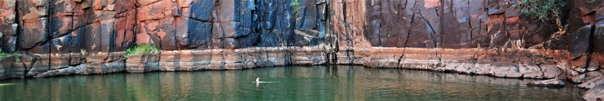
LANDCARE AT BKS NORTH LEURA (E) Cancelled. Join me and spend the morning doing landcare at Brahma Kumaris on Mt Hay Rd. All tools and instructions provided by a council worker. Usually we work along or in a lovely clear creek. Bring gum boots if you have them. This property borders the National Park so it's important to prevent weeds escaping into the park. Morning tea provided in the gorgeous Stone Cottage and stay for a complimentary vegetarian lunch if you wish. Limit: 8. Map: Katoomba.
3 May (Sat) 2025:
ANNUAL LEADERS BBQ Our club runs on the quality of our volunteer leaders and we love to hear you recognise, support and encourage them, so feel free to send them an email or make a Facebook post in appreciation of their contribution.
But for a little something extra, we like to gather once a year to shout them a meal and say thanks. We also want to encourage any club members who may have a hankering to join the leadership ranks with a BBQ lunch. Anyone who has led an activity with the club or who is interested in leading an activity, is welcome to attend... and as an added bonus, those who lead activities are given an extra discount toward their Remote Area First Aid course. Come and discover the benefits of volunteering. Map: Springwood
3-4 May (Sat - Sun) 2025:
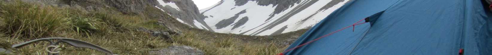
BURNT HOLE CREEK KANANGRA BOYD (M-Exp) Bit late for a creek walk but I really want to complete this postponed walk. From near the MT Werong campground leave the car/s at the gate on the firetrail, descend to the creek and find a camp then explore downstream. Return the next day via going upstream to Wattle Creek, up Wattle Creek and then onto the firetrail. Should be nice open creek walking and not too hard, 300m descent and ascent. Limit: 6. Map: Gurnang.
4 May (Sun) 2025:
DARGANS ARCH AND THE UPPER WOLLANGAMBE (M-H) This walk is now full. From Bell we visit Dargans Arch before heading East towards the "Centre of the Universe", visiting the "Ruin" on the way. Don't know what the "Ruin" is? Come along and find out!
We then cross the Wollangambe and climb Submarine Rock, to wander among the ridges and Pagodas on the North side, making our way back to Dargans Arch. Mostly Off track. Approx 13 kilometers,100-meter ascent/descent. Combined Springwood, Upper Blue Mountains walk. Limit: 8. Map: Wollangambe.
4 May (Sun) 2025:
GENOWLAN PLATEAU (M, EXP) This is a brief expedition on the Genowlan Plateau east of Capertee. The aim is to investigate a large round structure in the geology. We drive to Capertee turn right onto the Glen Davis road then drive up a very steep road to the plateau. 4WD needed (I have one). Park the car then walk a dirt road for about 2 km and check out what is there. The dirt road will give you some up and down walking thrills and the scenery is magnificent. We walk past the Valley of the Dinosaurs. It will be all day. Limit: 8. Map: Glen Alice.
5 May (Mon) 2025:
SPRINGWOOD (E) General Meeting Supper catering by Thais
Presentation:
Vic Giniunas will be showing photos and movie of his 22 day journey down the Samiria River in the Peruvian Amazon by dugout canoe. Limit: 8. Map: Springwood.
7 May (Wed) 2025:
YELLOW ROCK (E-M) A half day walk: Approx.5km: We will follow a fire road by Long Angle Creek to Fitzgerald Creek. At Fitzgerald Creek we will find an old camp site with rock caves. Long Angle Creek Valley has some magnificent trees. Bring morning tea. Limit: 16. Map: Springwood.
8 May (Thu) 2025:
GLENBROOK NP (M, cycling) Cycle in National Park from Glenbrook entry to Euroka, up Bennetts Ridge and on past The Oaks and down to the Nepean Lookout. Short snak with view, then back via road to the park entrance and on to Glenbrook for coffee or early lunch. About 30 km with steep climbs out of Glenbrook Gorge. Suitable for bikes with wider tyres. Limit: 10. Map: Penrith.
Introduction Walk
9 May (Fri) 2025:
CENTENNIAL GLEN BLACKHEATH (EM) Drive to Centennial Glen Rd and walk the link track to pick up the track down Centennial Glen with a short detour to see the views from Fort Rock. This track is very eroded in the upper section but we'll take it slowly. Walk behind a lovely waterfall and then continue down to the bottom with a look into an amazing little canyon. The bottom waterfall is really beautiful. This last section has steep steps with handrails but is optional. Returning part way up, we'll walk along the climbers' cliffs of Walls Ledge and return to the cars. About 5 km. Great views into the Megalong Valley. Depending on conditions we'll probably reverse the walk for better views. For those who want more we can drive to Hargreaves Lookout for lunch and more views and a short walk out to a very old lookout. This walk has everything all done at a pace to suit slower walkers. Limit: 15. Map: Katoomba.
10 May (Sat) 2025:
LOOK OVER TOWARDS KOLONGA LABYRINTH (M-Exp) Head out the end of Queens Road, Lawson on the North Lawson fire-trail, turn left and hopefully look out over the Kolonga Labyrinth. It looks back towards the ends of Urella and Rocklily fire-trails. Partially exploratory.
A hilly out and back route, approximately 13.5 km long. About 4 - 5 hours. Driver needed. Limit: 8. Map: Katoomba.
10 May (Sat) 2025:
MOUNT VICTORIA (M) Mount Piddington, Fairy Bower and Cox's Cave circuit. Please note this walk is now full and further bookings will go on a waiting list. Starting from Mount Piddington we will follow some tracks which date back to the 19th century to look at some pleasant woodland scenery, interesting rock formations, old rock carvings and a few spectacular views. You will be able to visit Cox's Cave but because this does involve ascending a ladder this will be optional. Once we return to Mount Piddington, we will head out on the fire trail to Horne's Point to enjoy some views over the Kanimbla Valley. This is not a big walk in terms of distance, about 6km, but does involve some steepish descents and ascents, around 300m descent and ascent, and some parts of the track may be slippery, hence, the medium grading. Limit: 10. Map: Mount Wilson.
11 May (Sun) 2025:
ASGARD PLATEAU EXPLORE (M) A 17km walk exploring some of the highlights of Asgard Plateau in the Upper Grose River area. We’ll visit several lookouts, a camp cave, Asgard Swamp, and a historic mine site. The route includes a mix of fire trails, bush tracks, and some off-track sections. Expect around 350m of elevation gain, with some rough and uneven terrain. A medium fitness will be required and is expected to take around 7 hours. Limit: 10. Map: Mou, Mount Wilson.
Introduction Walk
11 May (Sun) 2025:
FORTRESS RIDGE FROM MT HAY RD (EM) Drive out along Mt Hay Rd to the bottom of Fortress Ridge and then meander along this ridge to get fabulous views into the Gross Valley. The track is undulating with some eroded sections but we have plenty of time and the views are worth it. We finish at a point above Fortress Canyon and return the same way. Distance is about 8 km return. We'll need bigger cars depending on the condition of the road. It will be cancelled if the road is wet. Limit: 16. Map: Katoomba.
15 May (Thu) 2025:
GLENBROOK NP (M, cycling) Cycle in National Park from Glenbrook entry to Euroka, up Bennetts Ridge and back via road to the park entrance and on to Glenbrook for coffee. About 20 km with reasonable gravel on Bennetts Ridge, otherwise new bitumen roadway with steep climbs out of Glenbrook Gorge. Suitable for bikes with wider tyres. Limit: 10. Map: Penrith.
15 May (Thu) 2025:
SYDNEY (E) WATSON'S BAY TO ROSE BAY. From the Watson's Bay ferry wharf we will follow the contours of Sydney Harbour as we make our way to Rose Bay. Along the way we will be able to explore the rugged cliffs, secluded coves, parkland and remnant bushland of Sydney Harbour's eastern foreshore. In addition to some great vantage points of the Harbour there will be sandy beaches and some historic houses and gardens. If the weather is warm Parsley Bay and Nielsen Park offer shark proof swimming options. Total walk distance I am estimating at 8kms. Some stairs on the initial section of the walk but after this it is mostly flat Limit: 15. Map: Sydney Heads; Parramatta River.
17 May (Sat) 2025:
LANDCARE BIRDWOOD GULLY SPRINGWOOD (EM) Join me and Tracey from the council to clean up the very headwaters of Springwood Creek. This will prevent weeds getting into Birdwood Gully and lower to the Grose River. The creek here and the natural vegetation of tall Tree Ferns and gums are beautiful but are being choked by privet. It's the 3rd Saturday morning of each month but Tracey can look at a mid-week day if people want. All instructions and equipment supplied Limit: 12. Map: Springwood.
17-18 May (Sat-Sun) 2025:
GNW PATONGA TO STAPLES LOOKOUT (M) Continuing our assault on the GNW.
Day 1 - 10.5km Patonga to Mt. Wondabyne campsite (or possibly onto Kariong Brook).
Day 2 - 8km Mt. Wondabyne to Staples Lookout Woy Woy Rd.
Total 861m ascent.
Making this a limit of 4 as the ferry to Patonga no longer operates so we will need to be dropped to the start of the hike. My hubby will take the first 3 to book on after myself.
Happy to include more than 4, but will need to discuss travel options. Could be an UBER from Woy Woy station, water taxi from Brooklyn or arrange your own car drop off at Patonga wharf. Let’s chat!
(Unless otherwise stated ascents and descents are cumulative, eg. 100m up 59m down, 70m up etc.). Limit: 4. Map: Broken Bay and Gosford 1:25000.
18 May (Sun) 2025:
GLENBROOK GORGE (M-H) Sunday rock-hop down Glenbrook Gorge to the junction of the Nepean River. We'll have time for a quick late-season swim if the weather is still warm. Return via a ridge to the Bluff lookout. About 7km with some creek walking, scrambling and a few sections of steep climbing. About 170m ascent. Limit: 8. Map: Penrith.
21 May (Wed) 2025:
SOUTH HAZELBROOK (E-M) Todays walk has been cancelled due to inclement weather, also the Bedford and Terrace Falls Creeks will be torrential with water. A half day circuit walk at South Hazelbrook: 5km approx: From Lake Road Hazelbrook to Bedford, Lester and an unnamed pool in Bedford Creek. Then back up Bedford Creek to Willawong Pool where Lawson Creek joins Bedford Creek then back to Terrance and Victor Falls in Terrance Falls Creek, from there to Adams Lookout and the cars in Lake Road. Bring morning tea. Limit: 16. Map: Katoomba.
22 May (Thu) 2025:
GLENBROOK NP (M, cycling) Cycle in National Park from Glenbrook entry to The Oaks picnic area and on to the Red Hands Cave carpark. After checking out the hand stencils, back to The Oaks and then if it's fine enough ride on to the end of the road at the Nepean Lookout - bring a snack just in case. This optional extended ride is a total of about 30 km). Otherwise return to Glenbrook via the bitumen road (shorter option about 20 km). The roads from The Oaks to Red Hands Cave and to the Nepean Lookout are well graded gravel suitable for road bikes. The last few hundred metres of track down to the lookout are degraded gravel that all of us can walk if we want to. And there are steep rides out of Glenbrook Creek gorge in both directions. Coffee together at Glenbrook afterwards. Limit: 10. Map: Penrith.
24 May (Sat) 2025:
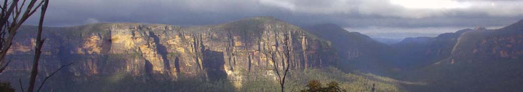
MT HAY AND BOORONG CRAGS (M) From the end of Mt Hay Rd we'll climb about 100m to the top of Mt Hay (no views). We'll then continue NE and scramble down about 100m to Venus Tor, then Boorong Crags where there is a view up and down the Grose River Valley. Return the same route. About 8km in total. Limit: 10. Map: Mt Wilson, Katoomba.
24 May (Sat) 2025:
THE SALT PATH MOVIE AT MT VIC FLICKS (Social ) A couple lose their home and later discover that the husband has been diagnosed with a terminal illness as they embark on a year-long coastal trek.
The dates and times didn't line up for Glenbrook... Limit: 50. Map: Katoomba .
Introduction Walk
25 May (Sun) 2025:
SUN VALLEY TO WARRIMOO (E) After a short car swap, we'll walk down Fitzgerald Creek via an old firetrail. This creek is very pretty with lots of nice trees etc. After we cross the creek we'll go back up the other side a short way to an old camping/picnic area set in below cliffs and a nice cave. We can climb the cliffs and explore a bit. There's even the remains of a dam and swimming pool. Then we continue up to Warrimoo via an old waterboard track or the firetrail if this is too eroded. About 6 km. Limit: 20. Map: Springwood.
30 May (Fri) 2025:
DARWINS WALK AND ROCKET POINT, WENTWORTH FALLS (E) We'll do a car shuffle then walk from town to the Falls via Darwin's Walk and a short section of street walking. Darwin's Walk was closed for a long time for repairs. The upgrade has made a pleasant walk of about 2km. Enjoy the views at the Falls then cross over the top of the Falls and climb a short distance on newly renovated track to Rocket Point and it's great views. If people are up for it, we'll walk about 1km along the fairly flat Undercliff track to the track just before Den Fenella which we will climb (about 70m) up to the Wentworth Falls carpark. If the group opts for a shorter walk, we'll skip Undercliff and climb about 70m back up to the carpark from the Falls. Limit: 12. Map: Katoomba.
30 May (Fri) 2025:
NEED NEW GEAR A visit to Summit Gear Shop in Katoomba where there will be a presentation on the Whippa Ultralight and Summit Gear ranges, and the differences in waterproof jackets. As well as info on trekking poles, how to fit correctly and how to use them.
Are there any other topics you would like to know more about? Available if requested prior based on member feedback.
Discounts on offer on the night only:
20% off Altra shoe and boot range
20% off North Face apparel
20% off in store sleeping mats - EXped and Sea To Summit ranges
20% off instore sleeping bags
15% off Sea To Summit 'Camp kitchen' range
Members get 10% off everything else in store with the exception of Summit Gear manufactured products.
They will also have clearance shoes, boots and clothing which are significantly marked down. Map: Katoomba
Introduction Walk
1 Jun (Sun) 2025:
LITHGOW DISTRICT (E) Lithgow is a very historic town so we'll be visiting various places of both scenic and historic significance. We'll start at Hassans Walls with it's great views and interesting rock formations. We'll check out the old track which goes underneath the walls to see if it's still doable. Then down to Lithgow to check out Secret Creek Australian Animal and Bird Sanctuary [cost involved] and maybe visit the Small Arms Museum or wander around the ruins of the iron and steel works which now have information boards. Limit: 20. Map: Lithgow.
2 Jun (Mon) 2025:
SPRINGWOOD (E) General Meeting: Catering by Steve Fuller Limit: 8. Map: Springwood.
4 Jun (Wed) 2025:
LEURA (E-M) A half day walk: 6km approx: We will start the Prince Henry Cliff Walk at Gordon Falls Reserve then go to Bridal Veil Falls Lookout and so on to Cliff Drive as far as the Solitary View Restaurant and Jamieson Lookout then down to Fossil Rock Lookout and Copelands Lookout. From there we will walk the Bridal Falls circuit and then back to Gordon Falls Reserve and the cars. Bring morning tea. Limit: 16. Map: Katoomba.
5 Jun (Thu) 2025:
LANDCARE AT BRAHMA KAMARIS (E) Join me and spend the morning doing landcare at Brahma Kamaris on Mt Hay Rd. All tools and instructions provided by a council worker. Usually we work along or in a lovely clear creek. Bring gum boots if you have them. Morning tea provided in the gorgeous Stone Cottage and stay for a complimentary vegetarian lunch if you wish. Limit: 8. Map: Katoomba.
6-9 Jun (Fri - Mon) 2025:
CENTRAL WEST NSW, SOUTHERN TABLELANDS NSW (H) King's Birthday Long Weekend. Self-supported cycle-touring / bike-packing on public roads.
Tarana - Pioneer Rail Trail - Oberon - Norway - Mozart - Vulcan SF - Mt Werong campground and stone cottage - Range FT - Lang Road - Wombeyan Caves - Goodmans Ford - Bullio Tunnel - Mittagong.
Camping preferred. 200km. 2500vm total climbing. 50% unsealed roads.
After getting off one of two daily Bathurst Bullet train services p.m. Friday, we will cycle under a rising waxing 71% full moon up the quiet unsealed Hazelgrove Road into the night towards Oberon for a Midwinter's Night Dream. You will still need quality bicycle-mounted lights.
Google Map route link; https://maps.app.goo.gl/ij22dUF8EbjTu8jb9 Limit: 28. Map: State Forests of the Bathurst Region.
14-15 Jun (Sat - Sun) 2025:
6HR PADDY PALLIN ROGAINE OVERNIGHTER (M, Navigation) Teams of 2 or more. I'm happy to do about 4hrs, not too fast... I'm planning on camping overnight Saturday rather than a super early Sunday morning start. Driver needed.
From the NSW Rogaining website...
Belangoloopy! The 6hr Paddy Pallin Rogaine (Sunday, 15 June 2025) is your chance to go loopy! Held entirely in native forest in Belanglo State Forest, you can expect to challenge yourself to big loops and big points with grand canyon views and steep climbs, or pamper yourself and team-mates with little loops enjoying time-honoured wandering through sandstone country with spectacular flora and fauna. Positioned about half-way between Sydney and Canberra a short distance off the Hume Hwy, the event will foster NSW/ACT rogainer-rivalry at its best.
At an elevation of around 700m, the cool forest air can be enjoyed from the moment you arrive at the Three Trees HH to the time you depart – plan your weekend accordingly as Belanglo provides unique opportunities for picking mushrooms in the pine forest, spending an additional night with the frogs at Dalys Campground, or sampling artisan fine food and wine from one of the nearby wineries.
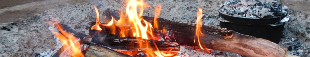
Costs about $45, no campsite fees, campfire allowed. Wood needed.
Limit: 8. Map: Canyonleigh .
Introduction Walk
15 Jun (Sun) 2025:
SOUTH HAZELBROOK (E) A 6 km, almost circular, very pretty walk passing Victor and multilayered Terrace Falls as well as several unnamed ones before visiting Willawong and Bedford Pools and ducking in to see Pyramid Falls on the way back up. Lovely rainforested creeks and cliffs. Some firetrail walking. Limit: 16. Map: Katoomba.
20-22 Jun (Fri - Sun) 2025:
BOUDDI NATIONAL PARK - CENTRAL COAST (M) On-track walking through Boudi NP to Maitland Bay, before joining the large annual 5 Lands Walk with live music and art en-route.
D1. Afternoon ferry to Wagstaff. 5 km, with 200 vm to bush camp vicinity of Box Head with views of Lion Island and Barrenjoey, or 7.5km walk to Tallow Beach campground. Gp booking required.
D2. 14km, with 400 vm. Killcare Beach - Hardys Bay cafe - Bouddi Coastal Walk - Maitland Bay - Bombi Moor FT - Little Beach campground. Gp booking required.
D3. 2km, with 100vm to MacMasters Beach. Then 10km, with 300vm as a casual beach and street walk to Terrigal as part of the 5 Lands Walk. Limit: 12. Map: Bouddi National Park.
21 Jun (Sat) 2025:
GNW WONDABYNE STATION TO GIRRAKOOL (M) Continuing our assault on the GNW in 2025.
9.5km - We will need to alert the guard that we are alighting at Wondabyne Station which mainly services the GNW. We then follow the GNW route over Scopas and Leochare Peaks which offer extensive views of the surrounding region. Our walk finishes in Girrakool which is an aboriginal word meaning “place of waters”.
Update: I now have 2 drivers willing to do the pickup at Girrakool, so can extend the limit to 9.
This walk requires a pickup from Girrakool Picnic Area. I currently have two drivers willing to pickup from Girrakool. Gosford Station is the closest train station from our end point.
Total ascent 776m.
(Unless otherwise stated ascents and descents are cumulative, eg. 100m up 59m down, 70m up etc.). Limit: 9. Map: Gosford 1:25000. Peaks bagged: 2
21 Jun (Sat) 2025:
LANDCARE BIRDWOOD GULLY SPRINGWOOD (EM) Join me and Tracey from the council to clean up the very headwaters of Springwood Creek. This will prevent weeds getting into Birdwood Gully and lower to the Grose River. The creek here and the natural vegetation of tall Tree Ferns and gums are beautiful but are being choked by privet. It's the 3rd Saturday morning of each month but Tracey can look at a mid-week day if people want. All instructions and equipment supplied Limit: 12. Map: Springwood.
23 Jun to 15 Jul (Mon-Tue) 2025:
HEYSEN TRAIL. (M-H-VH-Exp) I propose to walk in the north section Parachilna Gorge to Quorn, and a few days in the south section near Victor Harbor. Transport: we have 2 support vehicles. Mostly walking around 20 km a day and camping overnight in tents. Between sections of the walk we will stay in town accommodation. You will need to carry all your gear and probably extra water as the campsite tanks are not guaranteed to have water. If interested, book in on this site and I will be in touch. If you have specific needs or limitations, or questions, please email me. Participation limit depends on available transport. Limit: 8. Map: Heysen Trail map sheets.
Introduction Walk
29 Jun (Sun) 2025:
EMPIRE PASS NORTH LAWSON (E) A lovely 6 km round walk, much of which has been repaired with excellent stepping stones. Only the council section is still quite eroded but we'll take it as slowly as needed. We'll visit Dantes Glen and duck into St Michaels Falls before continuing down the pretty creek and around the point to go up another creek to Frederick Falls. Then we reverse this track but this time above the cliff line. Listen to the best echoing place in the mts and pass by magic Fairy Falls which has been coated with a glowing coat of iron. Limit: 16. Map: Katoomba.
3 Jul (Thu) 2025:
LANDCARE BRAHMA KAMARIS (E) Join me and spend the morning doing landcare at Brahma Kamaris on Mt Hay Rd. All tools and instructions provided by a council worker. Usually we work along or in a lovely clear creek. Bring gum boots if you have them. Morning tea provided in the gorgeous Stone Cottage and stay for a complimentary vegetarian lunch if you wish. Limit: 8. Map: Katoomba.
7 Jul (Mon) 2025:
SPRINGWOOD (E) General Meeting: Catering by Marie Jamieson Limit: 8. Map: Springwood.
19 Jul (Sat) 2025:
LANDCARE BIRDWOOD GULLY SPRINGWOOD (EM) Join me and Tracey from the council to clean up the very headwaters of Springwood Creek. This will prevent weeds getting into Birdwood Gully and lower to the Grose River. The creek here and the natural vegetation of tall Tree Ferns and gums are beautiful but are being choked by privet. It's the 3rd Saturday morning of each month but Tracey can look at a mid-week day if people want. All instructions and equipment supplied Limit: 12. Map: Springwood.
26 Jul (Sat) 2025:
SPRINGWOOD / WINMALEE (M-H) EOI. Night rogaine. Rogaining can be described as endurance orienteering.
Teams of 2 to 5. At this event to be likely based at (the 'Hash House') at St Columbas college grounds.
There is an entry fee of up to a probable $50 pp to NSW Rogaining.
My pace will be smart walking/continuous scrambling at best. There is a 3hr option and a 5 hour option, both starting at 5pm.
https://nswrogaining.org/2025-nightgaine/
Limit: 5. Map: Supplied with entry fee - Springwood..
27 Jul (Sun) 2025:
DHARUG DREAMING (M) Come searching for petroglyphs on the sandstone platforms in Dharug N.P. Starting at the Mill Creek Picnic area, the hike commences on track around half of the Grass Tree Circuit. There could be a bit of overgrown track for about 1-2km as we make our way up to the Eastern Commissioners trail. From here we should be able to explore a few rock platforms along the fire trail with very clear rock art. We return much the same way, taking the other side of the Grass Tree Circuit to finish back in the picnic area. Approx. 12km. Ascent approx 100m from lowest point to highest point. Not cumulative. Limit: 12. Map: Gunderman 1:25000.
4 Aug (Mon) 2025:
SPRINGWOOD (E) General Meeting: Catering by Brian S. Limit: 8. Map: Springwood.
7 Aug (Thu) 2025:
BRAHMA KAMARIS LANDCARE (E) Join me and spend the morning doing landcare at Brahma Kamaris on Mt Hay Rd. All tools and instructions provided by a council worker. Usually we work along or in a lovely clear creek. Bring gum boots if you have them. Morning tea provided in the gorgeous Stone Cottage and stay for a complimentary vegetarian lunch if you wish. Limit: 8. Map: Katoomba.
16 Aug (Sat) 2025:
LANDCARE BIRDWOOD GULLY SPRINGWOOD (EM) Join me and Tracey from the council to clean up the very headwaters of Springwood Creek. This will prevent weeds getting into Birdwood Gully and lower to the Grose River. The creek here and the natural vegetation of tall Tree Ferns and gums are beautiful but are being choked by privet. It's the 3rd Saturday morning of each month but Tracey can look at a mid-week day if people want. All instructions and equipment supplied Limit: 12. Map: Springwood.
16-17 Aug (Sat - Sun) 2025:
NAVSHIELD (E-M-H) Every year NSW SES Bush Search and Rescue organises and runs the Australian Emergency Services Wilderness Navigation Shield or Navshield.
This is a fantastic opportunity to practice your navigation skills (even if you're just learning, you'll be in a team). Register your interest here, we will need to book our places as they fill up fast. NOTE: this is for the 1-day event, you will need to be able to travel to the venue on Friday, leaving at mid-day. If anyone is crazy enough to do the 2-day, let me know when you book. Limit: 12. Map: not released yet.
16-17 Aug (Sat-Sun) 2025:
GNW GIRRAKOOL PICNIC AREA TO SOMERSBY FALLS (E) This would make a great introductory overnight hike and is also suitable for older children. Gear can be borrowed from the club with advanced notice.
Car shuffle required.
Day 1 - 7km - We head into the bush from the Girrakool picnic area down Piles Creek to Mooney Mooney Creek. We cross the old Mooney Mooney bridge and will camp overnight at the Mooney Creek campsite south (or north). Plenty of time for a spot of fishing to catch your dinner.
Day 2 - 7km - We continue to follow the GNW along Mooney Mooney Creek before detouring off to Somersby Falls.
This should be a pretty chill overnight walk at a relaxed pace with plenty of time for photography and exploration.
Total cumulative ascent 551m descent 448m. Limit: 8. Map: Gosford and Gunderman 1:25000.
1 Sep (Mon) 2025:
SPRINGWOOD (E) General Meeting: Catering by Jeanette L. Limit: 8. Map: Springwood.
4 Sep (Thu) 2025:
BRAHMA KAMARIS LANDCARE (E) Join me and spend the morning doing landcare at Brahma Kamaris on Mt Hay Rd. All tools and instructions provided by a council worker. Usually we work along or in a lovely clear creek. Bring gum boots if you have them. Morning tea provided in the gorgeous Stone Cottage and stay for a complimentary vegetarian lunch if you wish. Limit: 8. Map: Katoomba.
20 Sep (Sat) 2025:
SPRINGWOOD SPRING FAIR (E) Springwood Spring Festival previously known as Foundation Day. After the success of the stall last year, we will host another one this year and provide info to anyone who's interested. A good opportunity for us to be seen in the community. We will need helpers for the day to man the stall, chat to the public and hang out for an hour or so. Book on if you can help out. 8am-4pm. Limit: 8. Map: Springwood.
20 Sep (Sat) 2025:
SPRINGWOOD SPRING FESTIVAL Springwood Spring Festival previously known as Foundation Day. We will have a stall and provide info to anyone who's interested. A good opportunity for us to be seen in the community.
We will need helpers for the day to man the stall, chat to the public and hang out for an hour or so. Book on if you can help out. 8am-4pm. Map: Springwood
20-22 Sep (Sat - Mon) 2025:
GOULBURN RIVER NP (M-Exp) A big loop to explore the Goulburn River National Park by heading up the river and then cutting off the loop cross country on the way back. This is all new to the leader and with the long drive in a fair amount of time has been allowed to complete the trip. From the tight corner near Murrumbo Creek on the Bylong / Sandy Hollow road, park the car and follow the fire trail north for 2 kms to the river. Head upstream for 2 days to reach the first major southern tributary where I intend to camp on the second night. If we get there early we'll just explore upstream further. On the last day follow the tributary south and east then pop over the hills (150m or so gain) to reach the river about 2km upstream of the original firetrail. This is about 25km in total. Water purification, be it pills or filter, will be required, except if we're lucky on the southern tributary. Talking to the ranger there is a weed program ongoing on the river at the start of the walk for burrs so gaiters or equivalent maybe needed but after that it should be good. This country was not incinerated in the fires so hopefully the scrub is reasonably OK. Limit: 8. Map: Kerrabee etc.
21 Sep (Sun) 2025:
REMOTE AREA FIRST AID COURSE (Training ) The SBC Committee is again pleased to offer you an opportunity to get/renew your Remote Area First Aid, with the wonderful trainer, Frances Davidson, at the Pulse First Aid training room in Hazelbrook.
There is a compulsory online component and a full day of practical exercises, including 'in the field' scenarios.
The full course usually costs $300.
It has been offered to SBC for $150. The committee has reduced this to $100 per individual and $75 for activity leaders. You do need to be a full member to take advantage of this training. I will have a waiting list with 15 places, and if it fills, I'll add an additional day. Limit: 15. Map: Katoomba .
27-28 Sep (Sat-Sun) 2025:
SPLENDOUR ROCK (M-H, Overnight ) The walk starts and finishes at the Dunphy Camping Area, formerly Carlons Farm, in the Megalong. Approx 11km, 320m ascent, 6 hrs walking each day... There are ups and downs on the way, mostly quite gentle, but some bits are steepish. Via Medlow Gap and Mobbs Soak.
Then we climb about 120m up to Splendour Rock. The climb is fairly steep but should be do-able by most fit walkers. Pace will be moderate to slow. We'll camp on Mt Dingo. Water is not available at the campsite and needs to be carried...
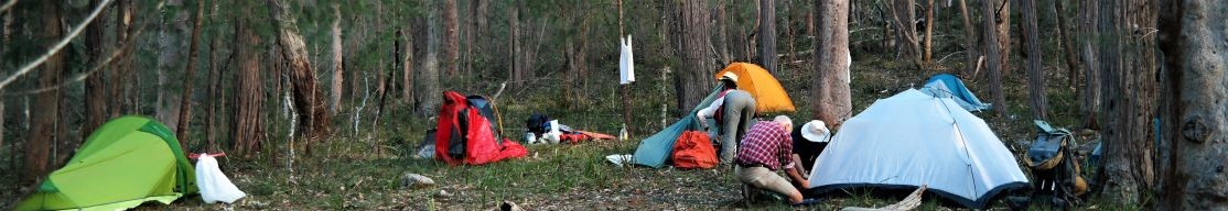
This overnight walk would be suitable for a first-timer as long as you can carry about 14kg. If you don’t have all the gear (tent, sleeping bag and mat, pack, stove, etc) the club has gear you can borrow. Let me know if this is your first overnight walk. Open to junior members. Carpooling. Limit: 8. Map: Jenolan .
28 Sep-3 Oct 2025 (Sun - Fri) 2025:
HIDDEN CREEK JERVIS BAY (M, kayak,walk,cycle) Five nights at Hidden Creek Caravan Park overlooking Currambene Creek. Tent or caravan on a campsites we have to ourselves.$25 per person per night. Cabins are also available at a discounted rate. We will be doing a number of day paddles in the surrounding waterways with opportunities for cycling, walking and swimming. Limit: 16. Map: Jervis bay.